


a sexy masterplan from dutch architect Maxwan is helping English Partnerships and bellway to redeem the 180 ha Barking Reach project. Josephine smit looks at what’s changed
On paper at least, Barking Reach has changed. It has been given the estate agent’s badge of Barking Riverside, and a blue and green coloured logo to match. Its old, suburban-style masterplan has been ditched in favour of a new version with vibrant jelly-coloured drawings of Manhattan-style living. And behind the scenes, developer Bellway Homes is delivering the scheme in a joint venture with English Partnerships.
All the scheme needs to get beyond paper change is the green light from Barking council’s planning committee for the outline application submitted at the end of last year. Approval will allow the 180 ha site to cast off its past and start afresh, albeit in an entirely new form as a city district with 10,800 homes at densities of up to 240 homes per hectare.
Barking Riverside needs this fresh start. The site has 2 km of desirable Thames frontage, is 17 km from Trafalgar Square, and was described in the London Plan as the capital’s largest housing development opportunity. But it also has some very well-publicised drawbacks. It has always suffered from a poor image, due to a lack of public transport links and the 7 km of power lines threaded from its all-too-prominent pylons. These problems were compounded in the early phases of development on the Reach in the 1990s, when the combination of high clean-up costs and low unit sales prices led Bellway to build basic box-like homes with little by way of parks or amenities to enhance the environment.
The new masterplan doesn’t solve all of the site’s problems.
The pylons remain, because the power lines are considered too expensive to bury. Public transport provision is uncertain: the East London Transit guided busway is planned for the early phases of development and the developers are crossing their fingers that by the time the new residents are packing out the buses, the government will have given the go-ahead for a Docklands Light Railway extension across the site to Dagenham Dock.
Amsterdam-on-Thames
But with projected housing numbers almost doubling under the new masterplan, the site is now a much better commercial prospect. This masterplan also creates a framework for design quality, including parkland and amenities that are essential if, as CABE remarked about the proposals, people are one day to say that buyers are lucky to live at Barking Riverside.
Bellway and EP set out their stall for the new masterplan by appointing trendy Dutch practice Maxwan to produce it. Maxwan’s masterplan provides only a strategic framework, with no detail of what the buildings will actually look like. “It establishes and tests the principles of whether the site can take nearly 11,000 units,” says Clive Wilding, project director with the Barking Riverside joint venture. The joint venture will be holding a series of design competitions to select architects for individual development phases and key buildings across the site.
Although Maxwan is not designing the buildings, the community it has created at Barking has a clear Dutch influence. It incorporates broad Dutch-style avenues surrounded by cosy neighbourhoods. “We started with a clear infrastructure with main streets, which the client initially thought was really puzzling,” says Paul Gerretsen, project leader with the practice. It was the lack of Poundburyesque country lanes – now being replicated on a housing development near you – that confused the client. But as Gerretsen explains: “This site is something like 14 times the size of Poundbury, so if you had curvy streets you would lose track of where you are. But inside the neighbourhoods you’ll find curvy streets.”
Stacked up
The masterplan has no place for the kind of landmark buildings that are central to so many UK regeneration schemes. “We don’t really believe in the power of them,” says Gerretsen. “They can pull an area up, but here one or two landmark buildings would be dwarfed.”
Although the Dutch are regularly praised for their design flair, it was ultimately their way with numbers that impressed Barking Riverside. “They come at it from the numbers to give the built form. That gives us the comfort overall that the numbers are viable. They have given us certainty,” says Wilding. The practice has a numerical model that takes on board such detail as the depth of gardens and car parking to show how homes can be accommodated.
Although the density of development is high, the masterplan has an assortment of parks and amenity spaces as the developer has chosen to use only 116 ha of the 180 ha site. Every home will also have its own private outdoor space, but that won’t necessarily be in the form of a conventional garden. “The idea of 30 m back gardens with a washing pole are gone, providing there’s some space in balconies, roof gardens and public realm,” says Wilding.
This fresh approach to Barking Reach is largely down to EP, which stepped in after Bellway had spent a decade trying to build its way out of a problematic site. Roger Bond, the Barking Riverside director who was working with Bellway on the site through the 1990s, sounds relieved to have EP alongside him. “It’s a huge advantage to us. We are sharing the risk and doing so with a partner that has the political will to make things happen.”
How the deal was done
Barking Reach was identified as a strategic regeneration opportunity when the power station closed 20 years ago.
Bellway began building homes with City Grant funding in the early 1990s, and its sales success with the first phase of 500 homes prompted it to buy more land from National Power to carry out a second phase of 500 units without grant.
National Power then invited bids for the remainder of its site, which also went to Bellway. At this stage the housebuilder joined forces with Barking and Dagenham council, which owned the 40 ha landfill site adjoining the power station, and a former allotment.
Bellway and the local authority were taking forward a masterplan to develop 6000 homes on the site, but life became increasingly difficult, says Bond: “As time went on, we became more aware of the costs of the site, the infrastructure costs rose and rose, and a few regulatory skeletons came out of the cupboard. We couldn’t make it viable. We had two or three quite difficult years, and it was all our own money.”
By the late 1990s, Bellway had started casting around for housebuilder partners that might join it in a consortium. But then it got a better offer. “The London Development Agency asked if there was an opportunity to help out by putting money in and increasing density. English Partnerships later took on the LDA role and we went on from there. We got to know the people, in the office and socially, and we felt it could work,” says Bond.
The joint venture acquired the land owned by Bellway and the local authority. Under the deal, the two partners have 50–50 voting rights, although Bellway owns 51% of the venture and EP 49%. Bellway has an option to develop up to 50% of the homes on the site, and the remaining 50% will sold to other developers as serviced plots. Bellway also has a 20-year service agreement to procure all infrastructure works.
The joint venture is putting £250m of funding into the site, with Bellway putting in £1 for every 50p invested by EP. The partners will share risks and rewards equally. The viability test for every development involves testing the return on capital and return on revenue against benchmarks based on Bellway’s standard development returns, which protects both parties. This time round Barking is marrying economics with quality – but a lot still depends on the Docklands Light Railway.
Client Barking Riverside (Bellway Homes, English Partnerships)
Masterplanner Maxwan
Landscape design Karres + Brands
Engineering Hyder Consulting
Environmental and geotechnical engineering Merebrook
Socioeconomic and commercial consultant Cushman & Wakefield
Environmental impact statement Waterman Environmental
Process management and planning application consultant Barton Willmore
Traffic engineering Peter Brett Associates
Ecology and landscape consulting LDA Design
Heres the plan
1 Roads The road hierarchy comprises primary streets, secondary streets and neighbourhood streets. The site has three primary streets, each one straight, wide and connecting to a main entrance to the site. Secondary streets serve not only as traffic arteries, but also as public open spaces within the neighbourhoods. They have curves, angles or bends to catch views. Neighbourhood streets give access to homes and possibly incorporate home zones. Neighbourhood streets are not incorporated into the framework plan.
2 Public transport Initially the site will be served by the guided busway, but the Docklands Light Railway is an integral part of the masterplan, with the proposed Beckton to Dagenham Dock extension having three stops in Barking Riverside. About 90% of the homes will be within walking distance of the DLR, but the route has not yet been given the go-ahead by government. Barking Riverside acknowledges its arrival is crucial: “By the end of the second phase, in 2016, we will need the DLR in,” says Wilding.
3 Car parking Parking averages 1.5 spaces per dwelling on the site and Maxwan’s Paul Gerretsen says the car is a fact of Barking life.
“This is an urban density and car use will be at the kind of level you would associate with the edge of a city.” Wherever there is on-street parking the architect proposes it should be on one side of the street only and perpendicular to the road. This would allow the same number of parking spaces to be provided as end-to-end parking on both sides of the street, but it leaves one side of the street car-free. There will also be a need for built parking, perhaps in the form of small undercrofts created under an area of a block, suggests Gerretsen.
4 Pedestrians and cyclists Pedestrian and cycle traffic is prioritised in neighbourhood areas within the immediate vicinity of homes. There will also be a pedestrian and cycle way, called “The Loop”, linking all the parks and amenities of the site. Other routes are planned to connect the neighbourhoods to their surroundings.
5 Flooding Some 2 million m3 of fill, including spoil from the Channel Tunnel Rail Link, is being added to the site to raise its level beyond the reach of floodwater. At the same time as ground is being built up, lower lying areas are being created within parkland to provide water storage capacity in the event of flooding.
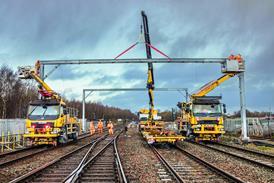
6 The pylons Pylons thread their way across the site from east to west. Although a recent report by the London School of Economics has said that burying all electrical cables was crucial to the success of the Thames Gateway, Barking Riverside director Clive Wilding argues that this is not a realistic solution. “By the time we have developed through the site, the pylons won’t be a major obstacle. The cost of putting them underground is huge and not within our budget.” Instead, the pylon buffer space of 30 m of open land between power lines and residential development is turned into a linear park. The positioning, height and species of trees in the park will be influenced by the power lines and so will park activities – kite-flying will definitely be prohibited. Trees will be planted around the base of the pylon to help conceal them. In addition to the power lines above ground, there are underground service corridors carrying cabling, which are being rationalised so that they run mainly in roads, parkland or in the overhead power line zone. There is a switching station at the heart of the site.
7 Ecology Although Barking Reach looks barren, its undisturbed land and watercourses support a rich variety of flora and fauna. Some of the site’s features are recognised for their ecological importance, notably the Ripple Nature Reserve, where pulverised fuel ash from the power station was tipped and where wild orchids now grow. The Thames mudflats must be safeguarded as they are used by wintering birds.
8 Open space Forty per cent of Barking Riverside has been designated as open space. There are park and ecology areas comprising Barking Riverside Park, the Barking Riverfront and three ecological corridors; and urban open spaces in streets, smaller parks and squares. The plan sets aside 3.6 ha as play space for children under 11 and 4.5 ha for sports pitches. The 40 ha Barking Riverside Park is the biggest open green space. This is 2.5 km long park and divided into 10 areas, including the Ripple Nature Reserve, a wetland reserve and an ecology park.
Barking in a box: How it’ll all be built
Guided growth strategy for the site
Stage one 2005-2010:
Years 1-6. 1784 units. The first local centre will be built providing a primary school, and retail, education and health facilities. Extension to the DLR and the East London Transit guided bus route are regarded as crucial.
Stage two 2010-2015:
Years 6-11. 3583 units. Residential development spreads east, and the district centre is developed. A second primary school will be built and transport links provided.
Stage three 2015-2020:
Years 11-16. 3363 units. The eastern half of the plan is realised and apartments are developed along the western waterfront. The Eye Square creates small business space.
Stage four 2020-2025:
Years 16-21. 2070 units. The focus of activity moves to Riverside Quarter with its high-value apartments.
Timeline
1994 Bellway starts building
1998 Bellway buys National Power’s power station site
2003 Bellway enters agreement with EP to develop Barking Reach
2004 Outline planning application for a development framework with 10,800 homes
2005 Infrastructure works are due to begin
2007 First homes completed
2025 Barking Riverside completed, with an estimated population of 30,000
Downloads
Heres the plan
Other, Size 0 kbHousing density map
Other, Size 0 kb
Source
RegenerateLive
No comments yet