


Policy will specify ŌĆśappropriateŌĆÖ sites for structures above 75m and provide contour map for tall-building clusters
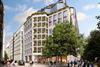
Proposals to rework the City of LondonŌĆÖs planning policies in relation to tall buildings will see specific sites in the Square Mile identified as likely to be suitable for new structures above 75m in height, in a change from current rules.
A report to a meeting of the CityŌĆÖs Local Plans Sub (Planning and Transportation) Committee said the City Plan 2040 blueprint for development would amend the current local plan document to provide more clarity on acceptable sites for high-rise buildings ŌĆō rather than identifying unsuitable sites.
The report said consultation work on the draft plan included observations from Mayor of London Sadiq Khan, who criticised the CityŌĆÖs current approach for being at odds with the capital-wide London Plan, which calls for boroughs to set out suitable sites for towers and ŌĆ£appropriateŌĆØ heights.

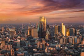
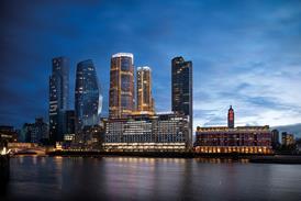
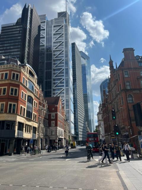
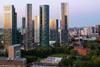
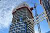
City of London planning officers said work on the new tall-buildings policy had seen the Square Mile divided up into nine ŌĆ£character areasŌĆØ for assessment. Just two of those areas ŌĆō the City Cluster and Holborn and Fleet Valley ŌĆō were considered suitable for new tall buildings after the areasŌĆÖ local heritage and the impact on views of St PaulŌĆÖs Cathedral, the Tower of London and other heritage landmarks was considered.
Officers said geometric three-dimensional mapping of the two areas considered suitable for new tall buildings had been conducted by VU City and Miller Hare to test the potential heights of tall buildings in each area as well as massing and ŌĆ£overall formŌĆØ.
They said the work did not address more localised character and heritage constraints, which could be appropriately dealt with on a case-by-case basis.
Committee members were presented with a report featuring further details on the proposals ŌĆō including more specific maps and heights ŌĆō in a part of last weekŌĆÖs meeting that the public and press were excluded from.
The City of London Corporation said the decision was taken ŌĆ£due to the commercial sensitivity of identifying specific sites as appropriate or inappropriate for tall buildingsŌĆØ.
The recommends that the 2040 City Plan sets out a contour map and ŌĆ£3D shape fileŌĆØ featuring heights for the two areas designated as suitable for tall buildings.
Officers said that the policy would also be amended to ensure proposed development in the City Cluster did not have an unacceptable impact on daylight levels in historic places of worship, including the grade I-listed Bevis Marks Synagogue.
Consultation work on the 2040 City Plan proposals is ongoing this month. A draft consultation document is expected to be published early next year.

No comments yet