With virtual planning and architectural critics judging from on high, Google Earth may transform the way we view buildings - and force us to make roofs more attractive
The regeneration of Liverpool and Manchester has made enormous recent years but not alas for visitors arriving on the Google Earth magic carpet.
According to regeneration body Liverpool Vision the aerial maps covering Liverpool’s key regeneration projects are five to six years out of date. London maps on the other hand include bang up-to-date landmarks such as Wembley and Arsenal stadiums.
Apparently Birmingham and Manchester are also represented by old satellite images, which has lead to accusations of a North South bias. Google claims it is reliant on third party providers for information and does not favour one city over another. Up-to-date coverage does seem patchy - Urbis is nowhere to be seen in central Manchester yet a friend is chuffed to bits that he can see his new shed on the outskirts.
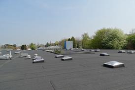
Many believe that Google Earth will have a profound affect on the way people view at buildings. A recent article in the LA Times suggest roofs will soon undergo a renaissance as architectural tourists cast a critical eye over the world’s rooftops.
Now visible to people other than balloonists, the awfulness of most roofs is now clear to see. Even award winning buildings are reduced to a mess of plant rooms and ductwork from the Google Earth viewer.
A recent ��ɫ����TV.co.uk focus group revealed that architects and developers are increasingly turning to Google Earth to scout out potential sites. Google is wise to the potential for this market. Earlier this year it purchased a piece of software called Sketch Up that allows you to build 3D models and place them on Google Earth in ‘layers’. You can share your efforts in Warehouse3D and latest this year Google says it will place the best UK models on their maps.
Microsoft also sees the potential for a world in 3D. It launched 3D Virtual Earth last month, which includes detailed replicas of 15 American cities. According to The Sunday Times Microsoft is now taking millions of pictures from planes, trains and automobile to stitch together a 3D landscape that users can walk or fly through.
Inevitably people will soon be interacting with a replica of the real world. You will be able to walk down a cloned high street plastered with billboards and shop online in your favourite real-world stores. Or maybe attend a virtual ��ɫ����TV Awards ceremony with clones of the sponsor and Denise Chevin handing an award to a replica version of yourself.
Microsoft says it is committed to providing a 3D user interface. The recent purchase of software called Photosynth, which allows smooth browsing of thousands of images, should help it achieve its goal.
The possibilities of virtual worlds for architects, developers and planners are endless. Planners for instance could place drawings on virtual maps to see how designs impact on the surrounding environment.
If the planners don’t focus designers’ minds on the roofs the clients certainly will. It's only a matter of time before the first building design is rejected on the grounds that it “won’t look any good from Google Earth”.












No comments yet