

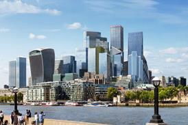


Mapping website Find has developed an online tool showing the height of buildings in the capital
The mapping website Find has launched a London building heights map. The online tool shows buildings with height points superimposed on them; similar to spot heights traditionally shown on walking maps for hills and mountains.
As well as showing the average and maximum height of a building it also displays its area and volume, together with the estimated number of residents and commercial floors.
Mariam Crichton, development director at Find, said: “Architects and planners have frequently asked us if reliable building height information is available, as it was not we decided to create our own building height model to solve their problem.”
In order to create an accurate building height map the company used sophisticated modelling techniques to combine UK mapping and height survey data.
The map can be used for viewing a site within the context of its surroundings, attaching height values to a planning application or just getting a feel for the surface terrain of an area.
The accuracy of the map has also been evaluated. In a recent test, One Canada Square at Canary Wharf, was only 760mm off its actual height.


No comments yet